
Tuesday 19th August: Malham to Horton-in-Ribblesdale – 13.5 miles
We were up early for breakfast – I urgently needed to get some laundry done, having almost ran out of clothes. Unfortunately however the washing machine in the guest laundry was hors de service. As I headed back upstairs to the dorm, one of the staff came up after me, offering to do my washing in their machine – which was really very kind of her.
Waiting for the Laundry
Whilst waiting for this, I went out and wandered around Malham. It’s not a huge place, certainly in terms of buildings. There is a quite a bit of open space here. Back at the Hostel, my laundry is done. We check out and then wait around in the reception foyer area for the tumble drying. It took an age: one hour and a half to dry my clothes, so we don’t set off until late in the morning: 11.20.
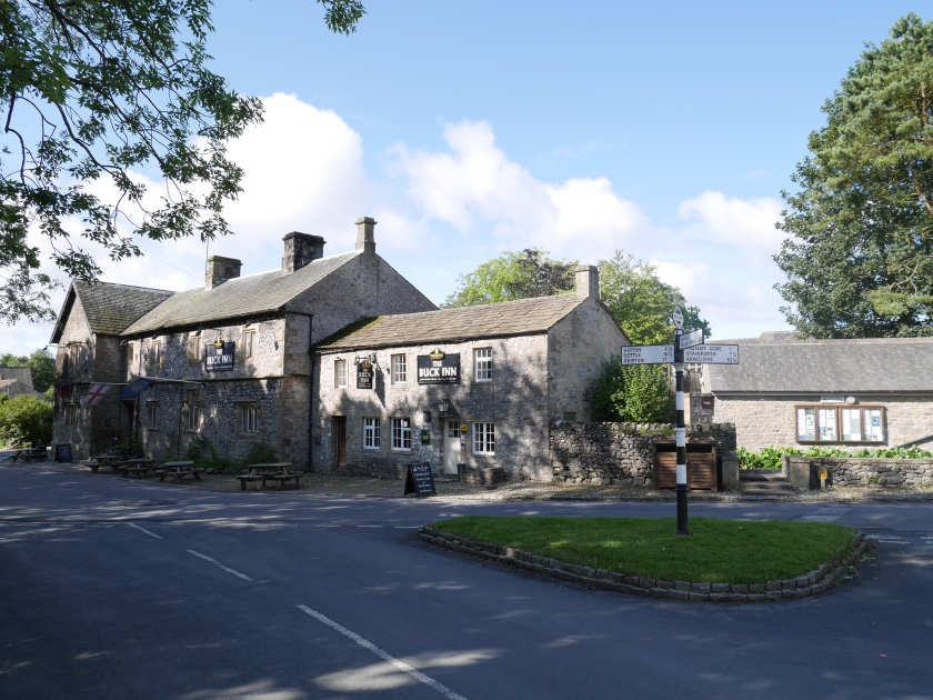
Stopping off at the village shop, I inadvertently barged in during the ice cream delivery. The slightly vexed owner, an old fellow in a blazer, was good enough to serve me (two flapjacks and a bottle of pop). We headed out of Malham north towards the Cove, veering off the tarmac road along a gravel path.
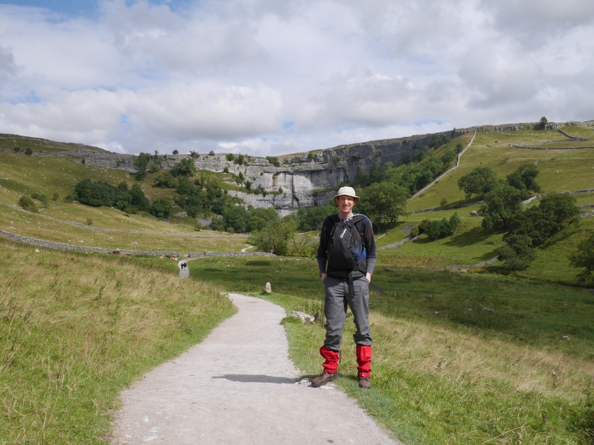
Malham Cove and Malham Tarn
Malham Cove is spectacular from a distance, a geological feature in 16:9 HD. Up close it was a bit more claustrophobic: its beck at the base, some trees, lots of vegetation and a reasonable number of people (I had figured it to be more of an open place, perhaps crossing it in my imagination with the Tarn).
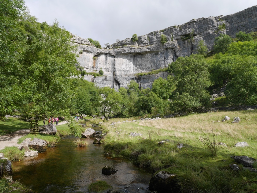
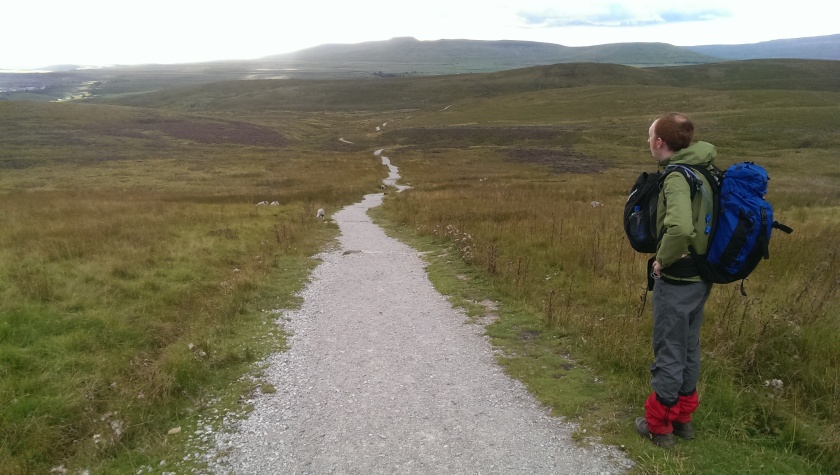
There were plenty of people (mainly small children) milling around and climbing up to the top, I felt somewhat incongruous amongst them, carrying my 90 litre backpack as kids wearing Liverpool FC shirts dashed up and down around the steps, up towards the spectacular limestone pavement.
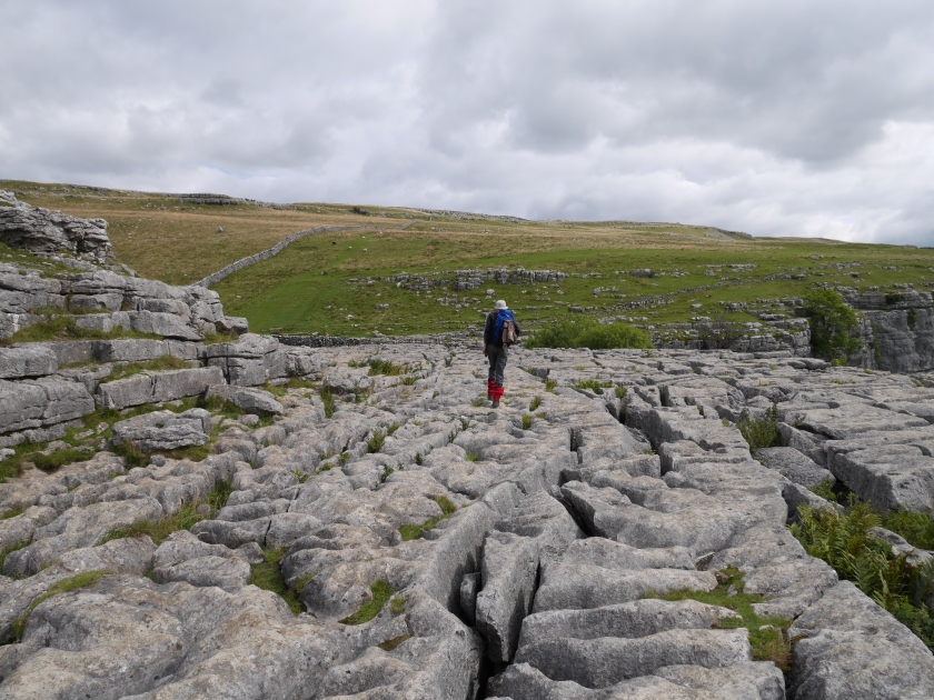
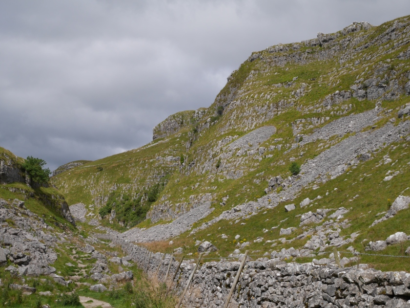
We then headed north through a striking dry valley (Watlowes) dressed in limestone, that reminded me of a Western landscape. The pavement was too extreme an example of nature perhaps (perhaps too static for a journey like this), but this walk up through the walls of stone I found more rewarding.
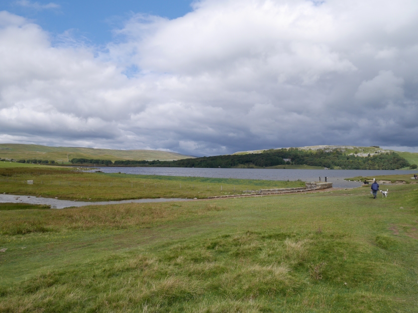
The rock started to disappear from the surroundings as we reached the top of the valley and ambled across undulating banks of grass towards the car park at Malham Tarn. This is a wide open, windswept place – the mass of water was much larger than I’d imagined it would be – certainly not a place I would contemplate swimming in. A track bent around the east of the Tarn for a mile or so and we stopped for our lunch just before it entered the woods.
On towards and over Fountains Fell
When we continued, the wood bounding the north of the tarn was dark, wet and unmemorable – its house was being renovated, looking like a shell. At the end of the trees we turned north again to head towards Fountains Fell. An elderly gentleman reposing 20 yards away on a tree trunk exchanged greetings with us – I couldn’t quite make out his accent.
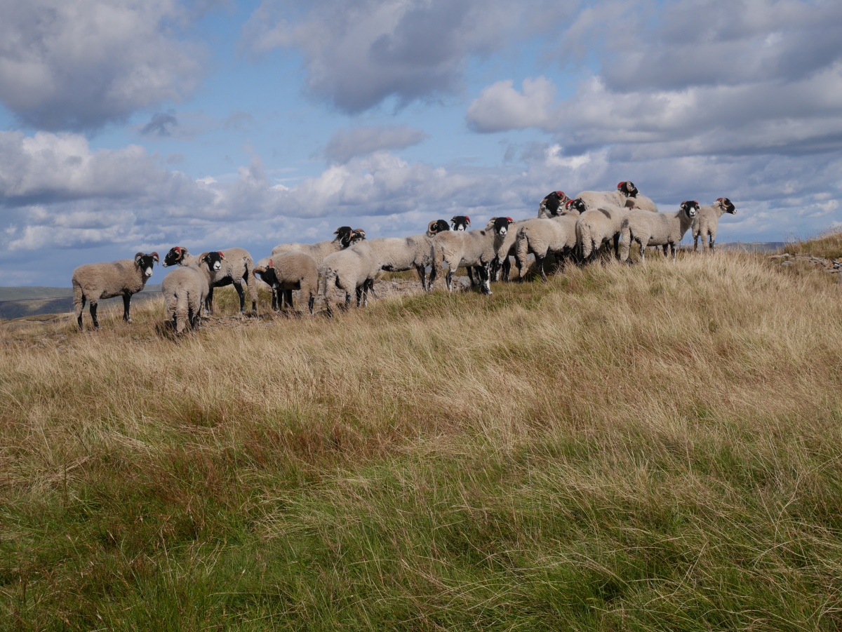
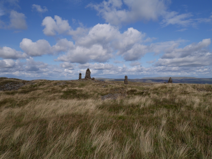
Most days post-lunch, we still had a lot of miles to walk and so had to push ourselves quite hard onwards: the country here was gently undulating farming fields that lead on (after another mile) to the climb up the fell: this gently inclined up well paved paths and wasn’t taxing at all. Fountains Fell was quite a nice walk, a gentle ascent. On the top I noted the stacks marking the mineshafts surrounding us, and a cluster of sheep.

The other side of the Fell was greener, wetter and had less of a path, and was more difficult. But it did offer a wonderful view of the next hill, Pen y Ghent, which stood like a great inverted liner hull across the valley.
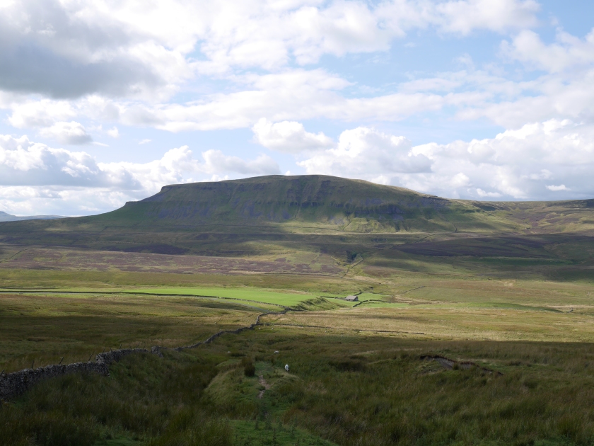
Pen y Ghent
Before that climb, in approaching there was a bit of a hack along the country lane for about a mile. At the junction with the path up to Pen y Ghent, we put down for a 20 minute mars bar break, when the elderly gent from two hours previous caught us up. On closer inspection he was a middle aged French fellow, just about getting by with a Michelin tourist map – he engaged us for our navigational advice interpreting its enlarged scale.
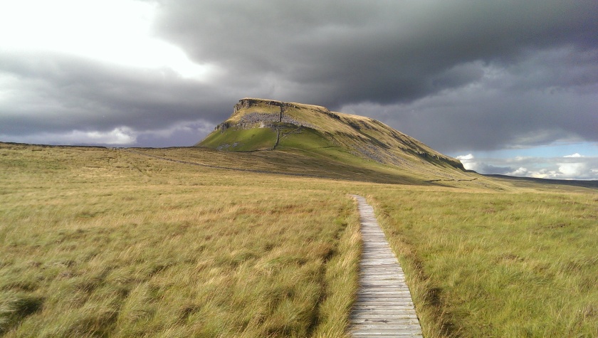
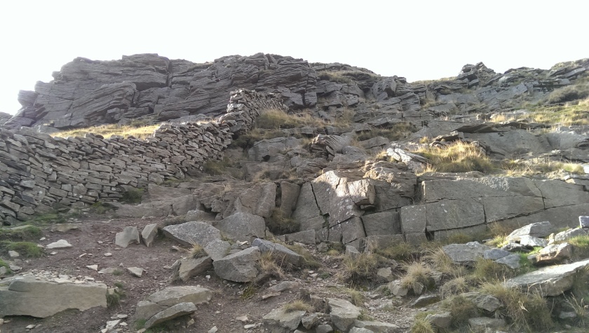
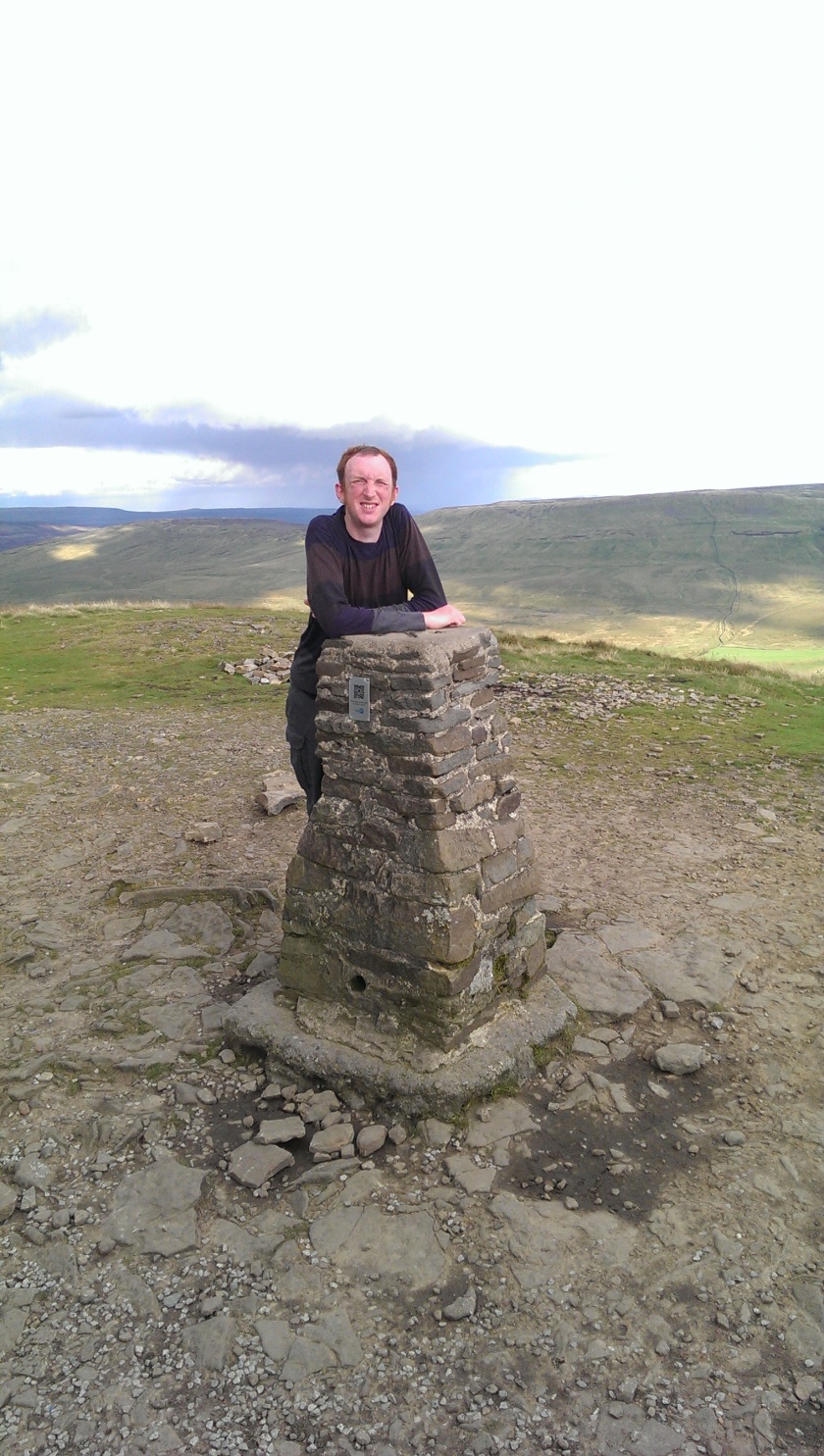
As we moved onwards towards Pen y Ghent, a trail of jet black clouds moved across the sky, along a plane beyond the summit – we didn’t like the look of them and deliberated over shortcutting for Horton instead. We eventually decided to go up – the climb wasn’t as difficult or as long as it first looked – two sharp climbs over steps and then the trig point suddenly arrives into view on a long, narrow top. We didn’t hang around long as the dark storm was still lingering above up.
Into Horton-in-Ribblesdale
The walk off Pen y Ghent was along gravel paths, which were sheer enough to test the joints after 12 miles of walking. After marching down to the plain above Horton, we then turned left to follow the farm track straight to Horton. A mile from the village a heavy shower did come down, getting us quite wet.
The Golden Lion was a large pub (again with a Burnley following), a little outmoded, but the rooms are comfortable and the food is fine. The routine that we settled into on the walk was a pub meal each evening along with a couple of pints. Back in our room I watch the TV: Arsenal were drawing 0-0 in Turkey.
A long but satisfying day’s walking – some of the scenic highlights of the walk and not in the end too hard.
